Our drone technology service offers significant advantages to our clients in surveying and mapping. With high-resolution cameras and precise GPS, we provide swift and cost-effective solutions, saving you time and resources.
Our drones capture detailed data, enabling more informed decisions, whether it’s construction oversight, land management, or environmental assessment. We reach remote or inaccessible areas easily, making your projects more efficient and data-driven
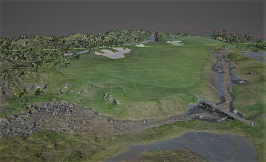
Our latest drone technology offers accurate and efficient 3D mapping and modeling services. Industries such as construction, architecture, and real estate, telecommunication can benefit from our high-resolution imagery and detailed 3D models for project planning, design, monitoring, marketing, and decision-making. With our expertise and cutting-edge technology, we provide valuable insights and save time and resources for our clients.
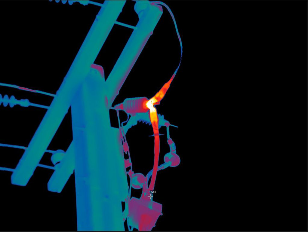
Our company specializes in using drone technology to help providers track and detect wastage or leaks in both electrical and water networks. By identifying leaks and inefficiencies early on, we help providers save money on costly repairs and downtime, while also promoting sustainability and environmental stewardship. Our advanced technology and experienced team make us the ideal partner for providers looking to optimize their networks and achieve long-term success.
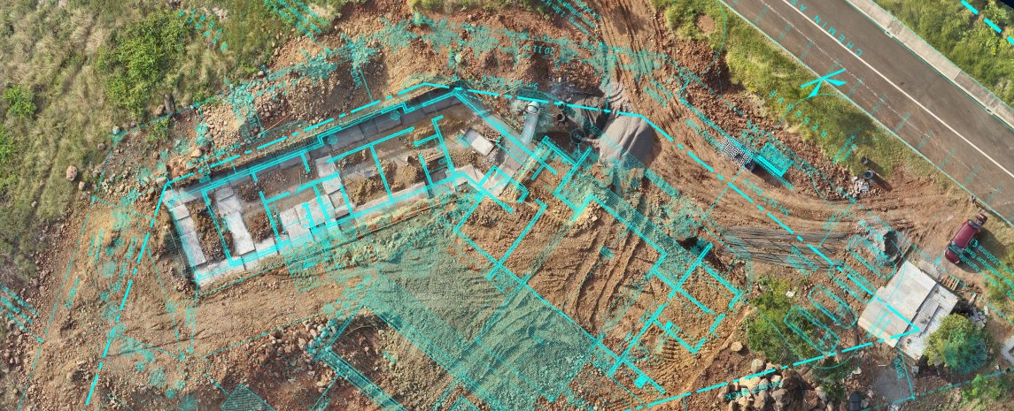
Elevate your progress monitoring with our drone services. Our advanced drones equipped with cutting-edge technology provide a unique vantage point, allowing you to track and analyze your project’s development with precision. Whether it’s construction, agriculture, or environmental monitoring, our drones capture real-time, high-resolution images and data, ensuring you stay informed and can make timely decisions.
By choosing our services, you gain an efficient, cost-effective, and data-rich solution for progress tracking.
Let us help you streamline your monitoring process and achieve better project outcomes.
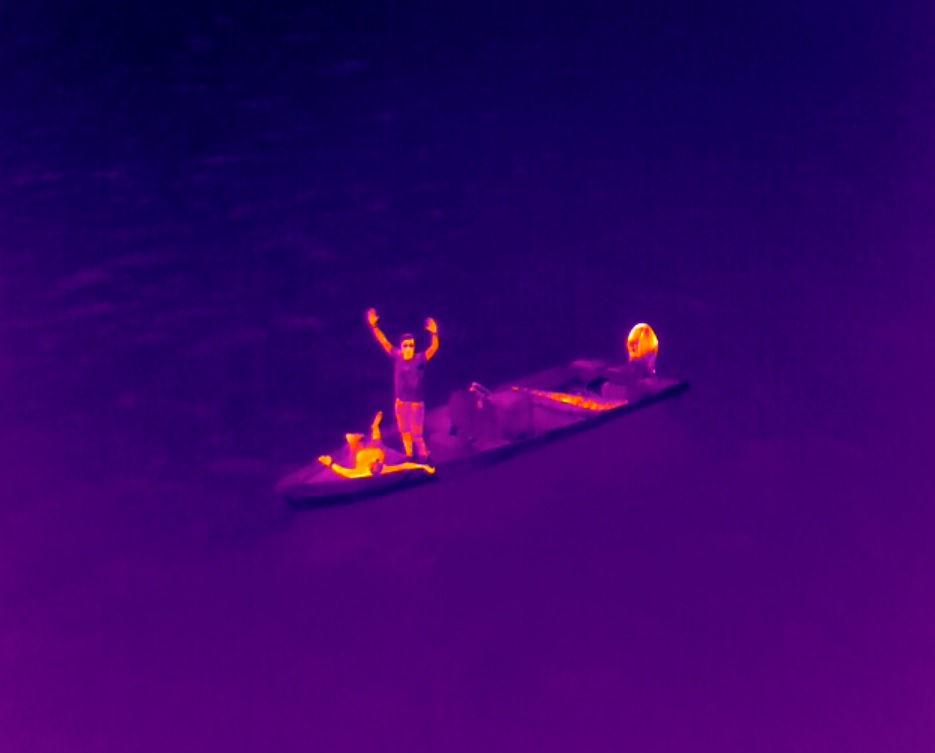
When it comes to search and rescue operations, time is of the essence. That’s why our company utilizes airborne thermal drones to aid in these efforts. Our drones can quickly scan large areas and provide thermal imagery that helps identify people in distress, even in low-light or nighttime conditions. This technology is particularly useful in remote or hard-to-reach areas where traditional search and rescue methods may not be effective.
By providing a quick and effective means of locating people in need, our airborne thermal drones can help save lives and improve the efficiency of search and rescue operations.
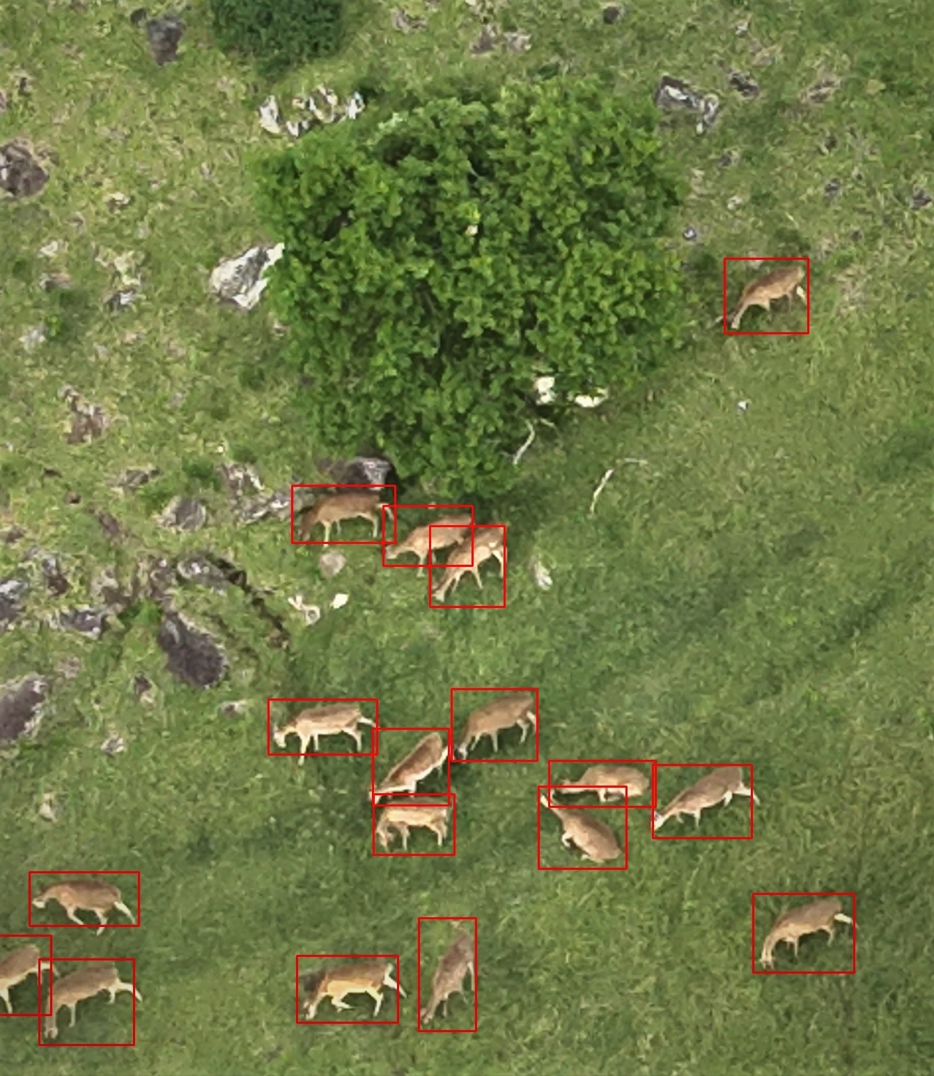
Our company uses cutting-edge drone technology and powerful artificial intelligence to count animal populations from the air. By understanding the size and distribution of animal populations, we can better manage resources such as food, medicine, and habitat to ensure their well-being. This data can also help inform conservation efforts and wildlife management strategies, allowing us to better protect vulnerable species and their habitats. Our technology provides a non-invasive and efficient means of monitoring animal populations, enabling us to gather important data without disturbing the animals or their environment.
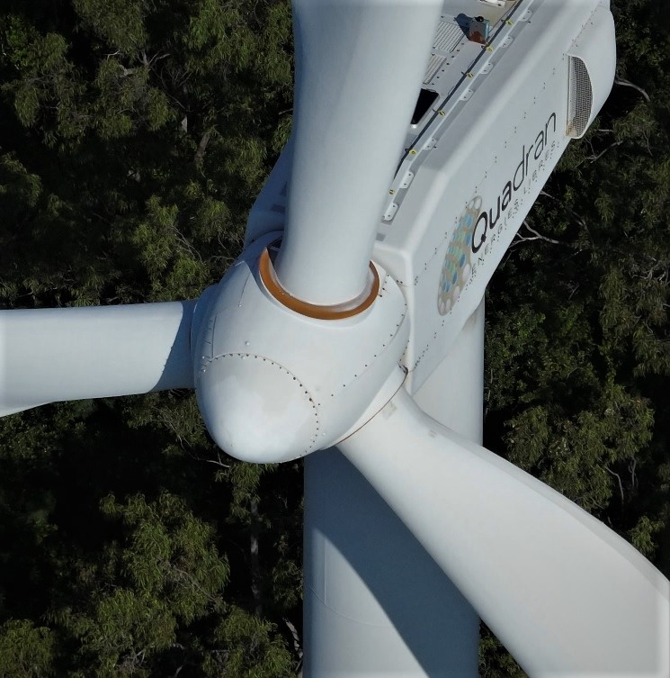
Discover the advantages of aerial inspection with our drone services. Our advanced drones provide safe, efficient, and cost-effective solutions for inspections, even in complex environments and hard-to-reach places, while significantly reducing downtime.
These drones excel in detecting issues swiftly, and the data they capture can be easily shared across your organization. From infrastructure assessments to environmental monitoring, we offer high-resolution imagery and data, enhancing your decision-making and operational efficiency. Opt for our services to streamline your inspections and enjoy the benefits of improved issue detection, seamless data sharing, and a more comprehensive and informed approach.
Our company is dedicated to finding new solutions to save water and is actively involved in developing and innovating in partnership with local companies. Climate change has led to an increased risk of water scarcity, making it vital that we work on solutions to protect this essential resource to sustain our civilization. With the growing concern over water scarcity and the need to reduce water waste, our team is focused on developing sustainable and cost-effective solutions. By taking a proactive approach to water management, we aim to help ensure a more secure water supply for future generations.
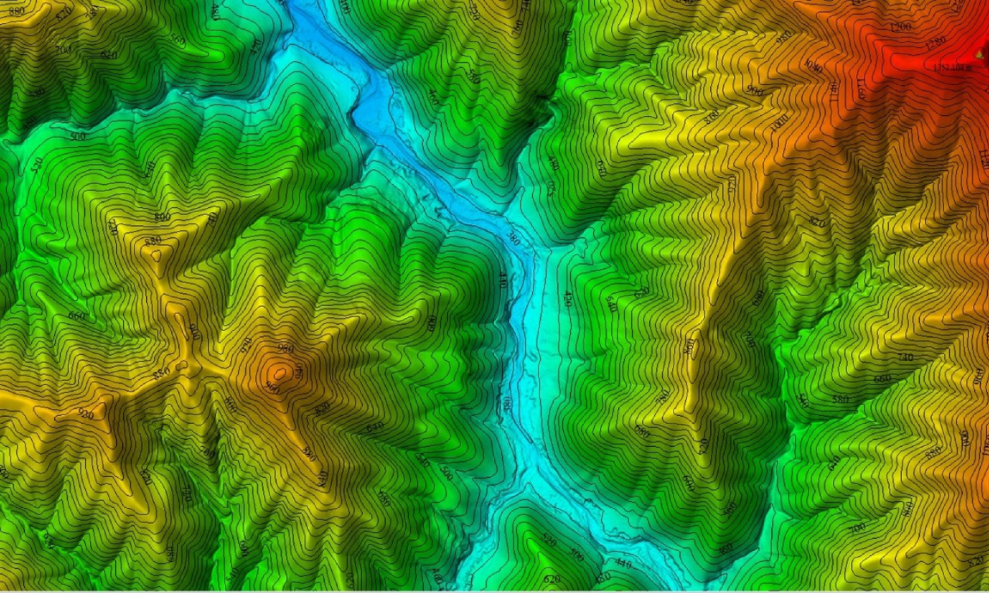
LIDAR, or Light Detection and Ranging technology, is an incredible asset in surveying and mapping. With its advanced capabilities, LIDAR utilizes laser pulses to measure distances, making it possible to create highly accurate 3D representations of terrain. One of its most remarkable features is the ability to survey land through tree canopies, allowing us to obtain detailed topographic data even in densely vegetated areas.
We are thrilled to announce that our company has been approved by Civil Aviation to operate commercially this cutting-edge technology.
For more information on how LIDAR can transform your projects and provide you with precise land surveys, please contact us to explore the details of this exciting development.